RiverCityMalone.com

On the issues that matter in Malone NY (USA)

Wooden Pipes

In Praise of
Malone's Drinking Water,
Part Two

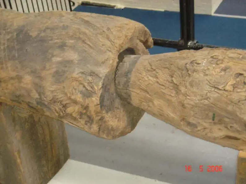
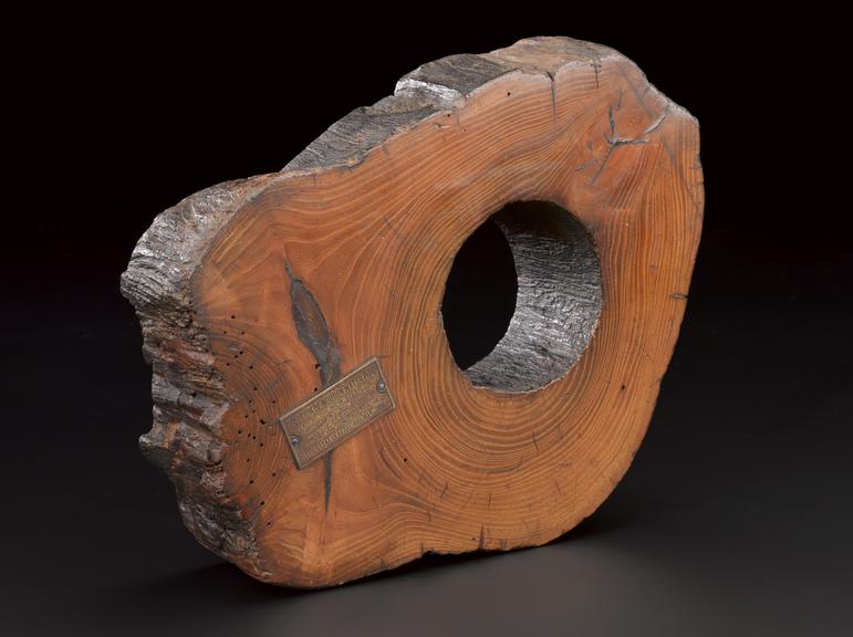
Cross-section of a water main, London, England, from the turn of the 17th century. The pipes consisted of massive,
hollowed-out elm tree trunks laid end-to-end.

Picture of Calvin Luther Martin, PhD

Calvin Luther Martin, PhD

August 29, 2024

A crash course on how NOT to handle
municipal water and sewer

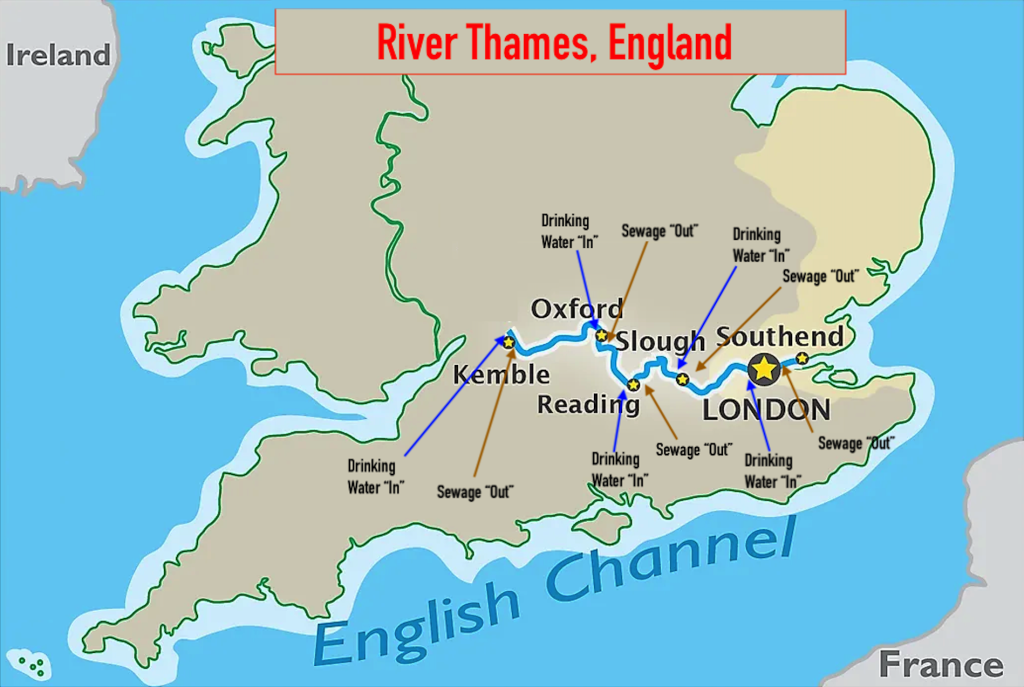
Let’s use the Thames River, England, as an example. In the olden days, villages, towns, and cities used brooks, streams, and rivers as both “open air” sources of drinking water (buckets, aqueducts, rudimentary pipes) and “open air” sewers (buckets, aqueducts, rudimentary pipes). Yes, the same river.

Examine the map, below, and you see how it worked. You extract your drinking water at the upstream side of the river and dump your raw sewage somewhere farther downstream

This works okay, except for communities located downstream. 

Note that all the towns and cities along the Thames followed this procedure. 

I’ll leave the rest to your imagination, except to say that one of the reasons why people copiously drank wine, liquor, and beer centuries ago was because the municipal drinking water was someone else’s sewer main. (At least the booze didn’t give you typhoid fever, cholera, dysentery, hepatitis A, etc.)

You really didn’t want to live in Southend, England, back then. You literally lived at the end of the nation’s main sewer line.

Malone did the same thing in its early years. So did virtually every other village, town, and city throughout America. 

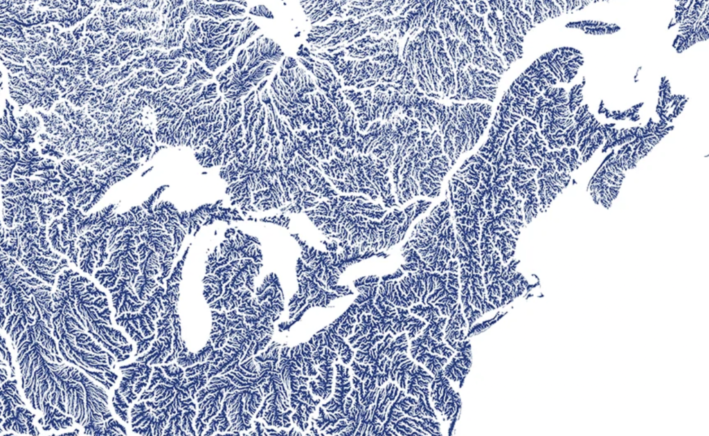
Notice the map, below. It was created from a satellite view of the Northeast—showing rivers, streams, brooks. (Yes, the waterways have been exaggerated for viewing purposes.)

That’s a whole lot of brooks, streams, rivers, ponds, and lakes to (a) access drinking water and (b) dump raw sewage into.

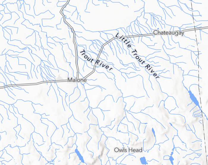
Now focus on the map to the right, showing the waterways around Malone. Numerous and extensive. Ideal for accessing getting water and sewage disposal. Also ideal for hydro-power to run the mills that were built along the Salmon River. 

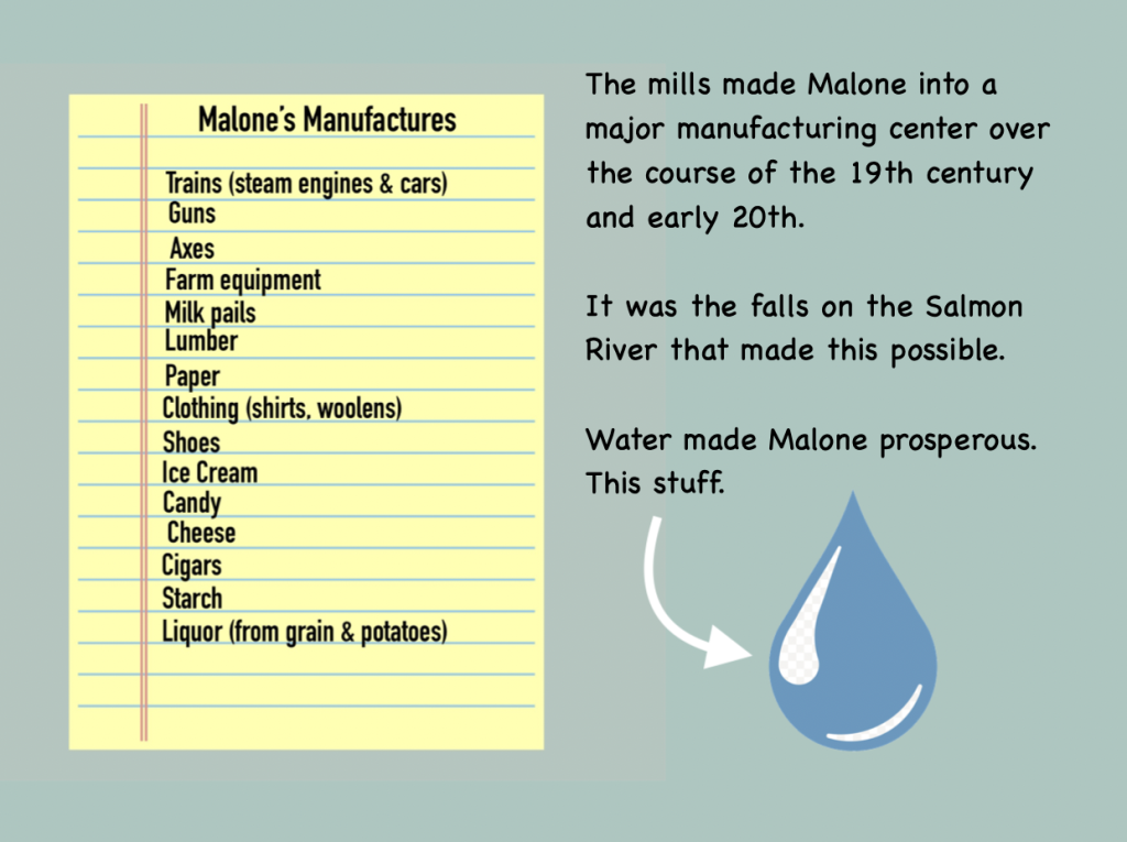
I’m going to digress from “drinking water,” because it’s important to appreciate the context in which Malone responded to its drinking water needs. And that context has everything to do with the economic state of the community. In short, during the 2nd half of the 19th century, Malone became very wealthy.

Malone’s economy, from day one, was powered by the Salmon River. So, in fact, was the economy of most towns and villages in America from colonization well into the 19th century.

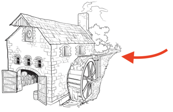
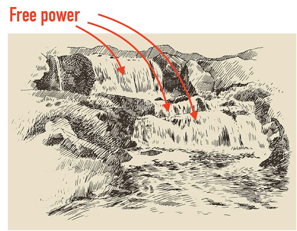
It’s essential to understand that Malone was built at the “fall line” of the Salmon River. Examine other American towns and cities in the colonial period and 19th century and you will find that they, too, were built at fall lines. Water falls and rapids meant free hydro-power for mills. (Keep the “fall line” in mind as a key determinant of settlement in American history.)

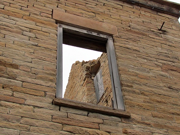
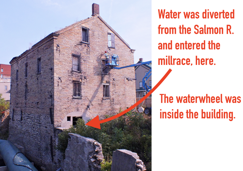
Detail of the outer wall of Horton Mill.
(Photo courtesy of Mindy Robinson.)
There were several of these mills along the Salmon in the Village of Malone: Horton Mill (Mill St.) 1853, the Munger Grist Mill (Lower Park St.) 1870, Ballard Mill (Ballard Pond) 1829. Note that the mills were driving machinery directly, not by producing electricity, which had not been invented.

Horton Mill.
(Photo courtesy of Hugh Hill.)
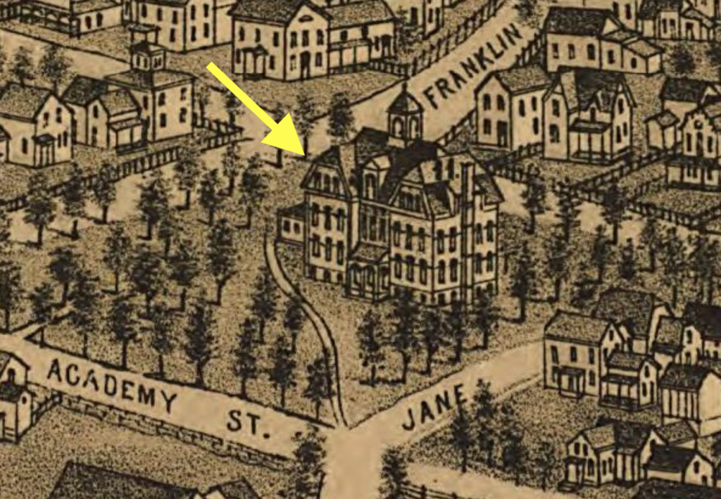
“A writer told in the Palladium [Malone’s newspaper at the time] sixty years ago [1858] that two early [Franklin Academy] teachers were discharged for intemperance (fortunately their names are lost), each having had a bottle of brandy in his pocket in the school room during school hours.

“Happily, the character of our teachers since then has been of the highest, and their examples proper for the young to follow” (Frederick J. Seaver, “Historical Sketches of Franklin County and Its Several Towns,” 1918, p. 419.)

Malone 1886

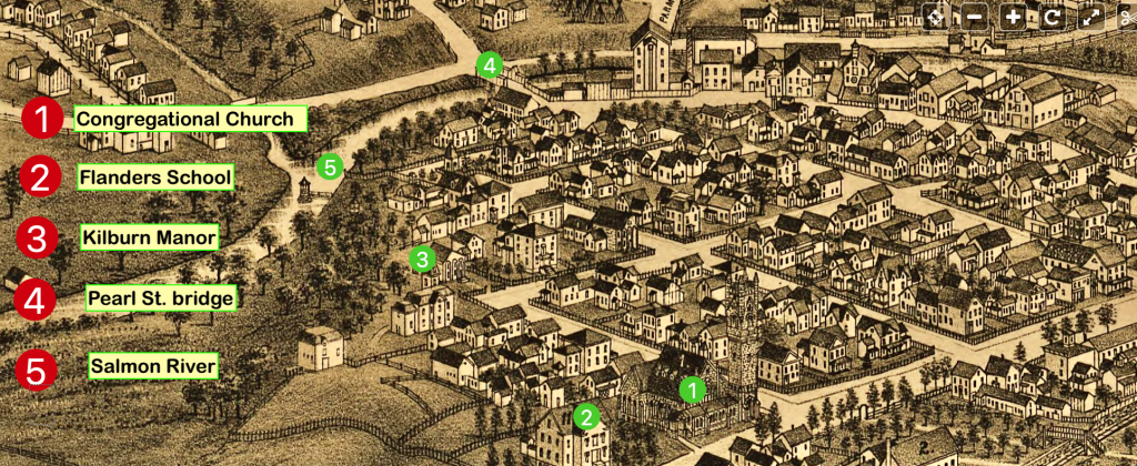
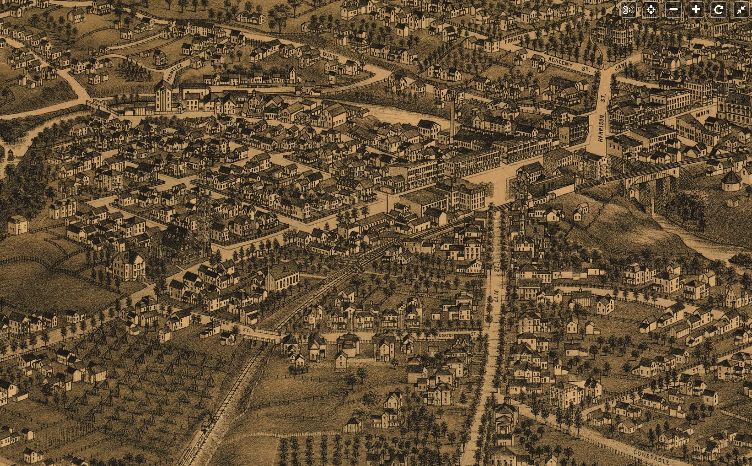
Back to Malone’s water. I need to get you in the frame of mind to appreciate Malone in the 19th century (i.e., the 1800s).  I’m going to do this with this stunning, hand-drawn map of Malone, created by Lucien R. Burleigh (Troy NY) in 1886. Click the button to read about this celebrated artist.

Burleigh drew close to 300 of these maps, of cities and towns across America. This one is available through the Library of Congress.

Right off the bat you realize, “Omigosh! Malone must have been a big deal to rate a map by an artist of this caliber!” In this you would be correct; Malone was a big deal, because of its manufactures. The manufactures were possible because of the Salmon River.

As you scrutinize the map, below, realize that the artist went down every street and hand-drew every structure in minute detail. Not only that, he got the proportions correct and geography perfect! (For my house, at 19 Clay Street, he noted the rounded windows in the living room. Notice that he shows my house being 2-story. It was indeed 2-story at the time. The 2nd story was eliminated after a disastrous fire in 1946.)

Open the large, dynamic map below (third map, below), and find your house. Find landmark buildings. You will be blown away!

Take a look at Franklin Academy, for instance, where the boozing teachers worked — and drank. (They had been relieved of their pedagogical duties long before Burleigh arrived.)

Place your cursor anywhere on the map, below, and zoom in. Go ahead, have fun!

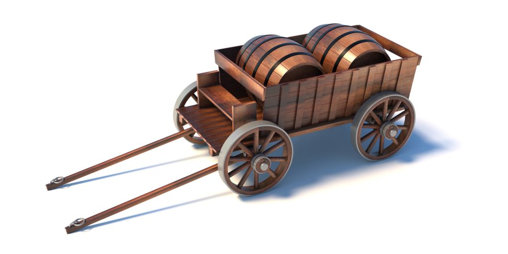
How did everyone get their drinking water when Burleigh made his map?  I mentioned at the end of Part 1 that in 1857 a man named Baptiste Monteau was going house to house delivering water from a barrel on a horse-drawn cart. He drew the water straight out of the Salmon River. Besides Monteau’s deliveries, we can assume that many homes and presumably businesses and so forth had their own dug wells.

This is how I imagine
Monsieur Monteau may have looked.
This changed in 1857, when town fathers realized that the Salmon, though abundant, was too vulnerable to pollution. Thus the Malone Water-Works Company was launched that year with the purchase of “a spring flowing a hundred thousand gallons a day south of the village” (Frederick J. Seaver, “Historical Sketches of Franklin County and Its Several Towns,” Albany NY, 1918.)

I have not been able to definitively locate this spring in the historical record—the historical record consisting of Seaver’s, “Historical Sketches,” cited above. (Click the button to the right for a PDF of Seaver’s book—the entire book. It’s fascinating reading.)

The spring, however, was clearly not Malone’s first piped-water system. On p. 419 Seaver mentions that in 1810 the Malone Aqueduct Association “was incorporated by act of the [state] Legislature to supply the village of Malone with wholesome water by means of aqueducts.” Appelton Foote, George F. Harison, and Warren Powers were named as directors of the enterprise.

The problem with this venture, says Seaver, is that he couldn’t find any evidence that the Aqueduct Association did anything. 

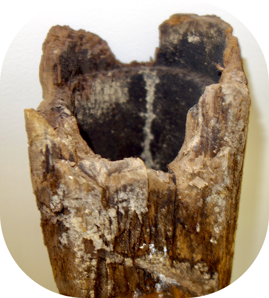
On the other hand, he says that “during the progress of work on our present water system [presumably in 1857], pipe logs were found on Water and Catherine streets—no memory of the laying or use of which even the oldest inhabitant recalled, and it was understood that similar pipes were laid on Webster and Main streets.” 

The pipe logs were likely made from white pine or cedar trunks, since both trees do well with being water-logged. Yes, I mean water mains made from massive trunks with a bore-hole through the center. The trunks were butted end-to-end, as shown in the image to the right.

“There was, too, in the ‘long ago,'” continues Seaver, “a pipe line from the Hosford Spring east of the fairgrounds across the Flat, but whether it belonged to the 1810 system is not known. The source of supply for the Foote-Harison-Powers system was a spring in the, then, Parmelee sugar bush, which was east by south from the Webster street cemetery.” To which he adds, “An enterprise in such a time is certainly remarkable.”

Remarkable indeed!

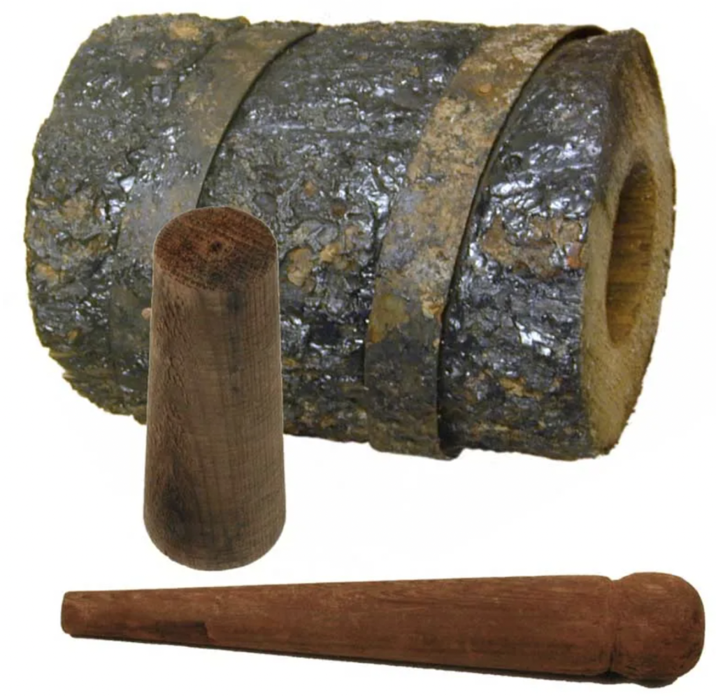
Shown, above, is one of the mysterious pipes referred to by Seaver.
It's about 5 feet long and in the mayor's office.
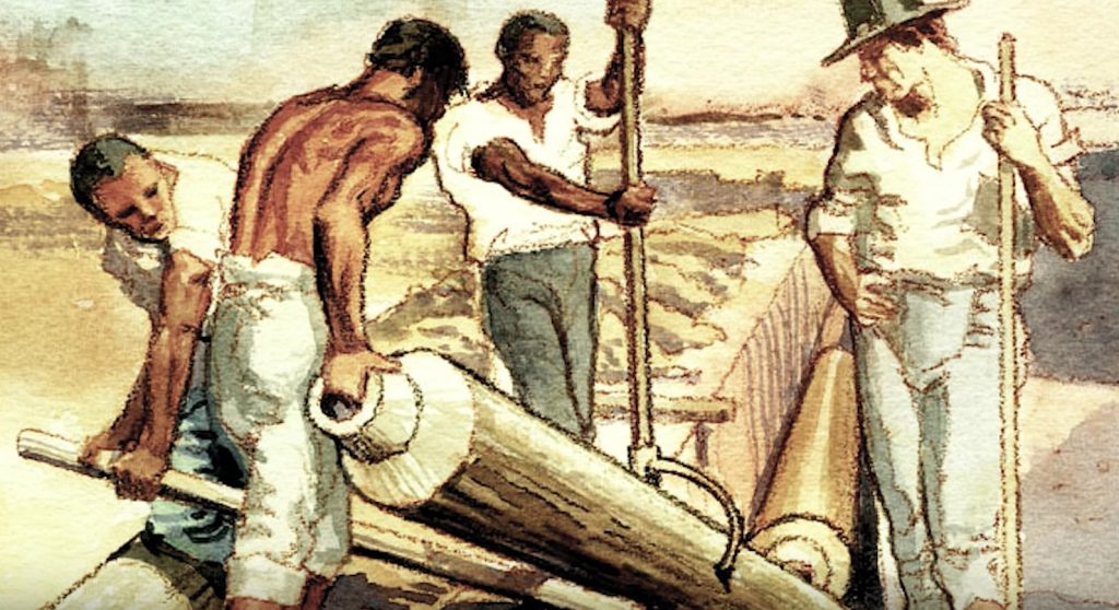
These water pipes are not from Malone
What you're looking at is a short section removed from a wooden water main (not from Malone), with iron straps around it. When fire departments needed water, they dug down to the wooden water mains, bored a hole, and scewed in a hose. When they were done, they hammered a wooden plug (peg) into the hole. If they needed to access water again, they simply removed the plug and screwed in a hose. Thus the origin of the term, "fire plug."

Hmm. It looks like Monsieur Monteau may not have been the sole source of water delivery, besides private water wells, in the mid-19th century.

Back to Seaver. As I quoted him, above, “In 1857 the Malone Water-Works Company was incorporated, and purchased a spring, flowing a hundred thousand gallons a day, south of the village, as a source of supply. Mains [presumably made of cast iron, not tree trunks], which were supposed at the time to be abundantly large, but which proved to be wretchedly insufficient, were laid along the principal streets, and it was thought that provision had been made to cover all domestic and fire needs of the village ‘for generations to come.’”

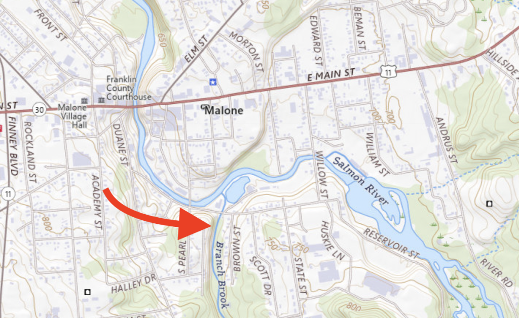
Alas, the Water-Works Co. was overly optimistic; “less than twenty years had elapsed when clamor for more water began to be insistent, and after a time another spring nearby, and then still another to the east and even the Branch [Brook] stream were added one after another to the system.” 

See Branch Brook indicated with the red arrow, to the right.

“Still the supply was inadequate,” writes Seaver, “and the head [pressure] for fire purposes miserably insufficient.”

Eighteen-eighty-eight was a banner year for Malone’s water. “In 1888 the water company was reorganized, with a considerable increase of capital.”

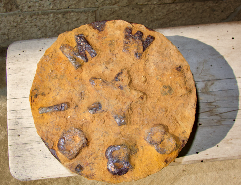
This cast iron water cap marks the new water era. The cap is on exhibit at the water treatment plant. The “MW” stands for “Malone Water-Works,” the star stands for the village’s motto, “Star of the North,” and the date shows 1888, when the company was reorganized.

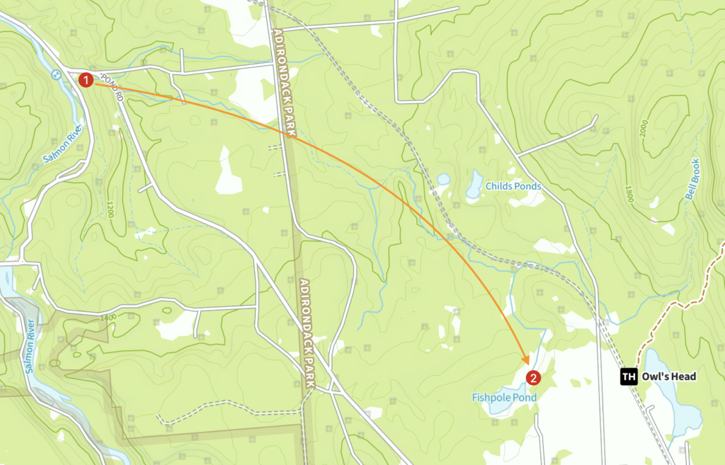
Fishpole Pond and Fishpole Flow (aka Horse Brook),
showing the route to Chasm Falls.
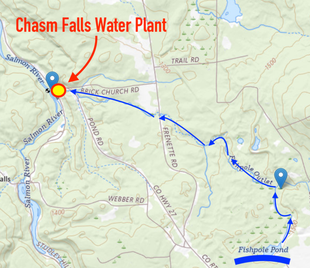
This time the village made a bold move, opting to shift the municipal water supply to a stream “seven miles south in the Adirondack foothills, and fed altogether by springs.” The stream was called, at the time, the Horse Brook.

Today we know it as Fishpole Pond or Fishpole Flow, shown in the map to the right. 

“Flow” refers to the fact that it is a filigree of streams, marshes, and ponds all traveling in the same direction. 

This lacey waterway ends its journey precisely where the Chasm Falls waterworks is presently located.

Ignore the blue "teardrop" markers on the map.
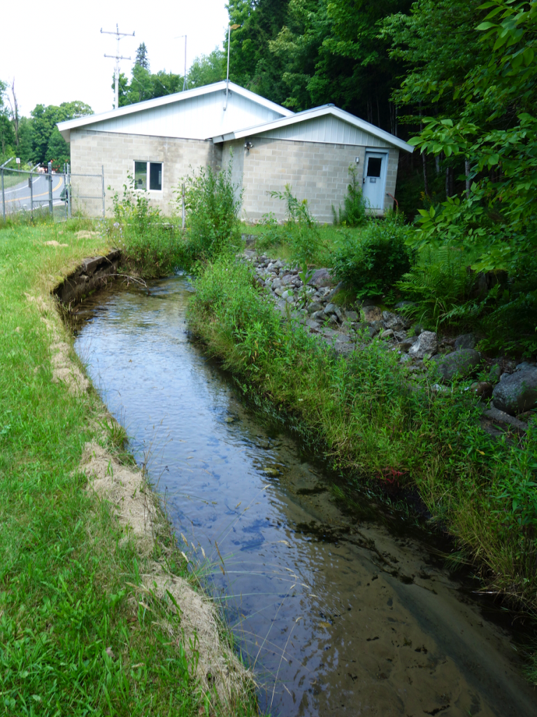
The original Chasm Falls waterworks building,
with the man-made channel from Fishpole Flow flowing into it.

Fishpole Flow (Horse Brook) “became the principal source of supply, with . . . a capacity to deliver a million gallons a day at the reservoir, which was located on the Pinnacle, near the village, at an elevation that affords a pressure of 90 pounds in the business center.”

Seaver ends with a hurrah: “There is no finer system anywhere, nor any purer water, which, however, would be preferable if it were less ‘hard.’” Adding, “there is still complaint at times that the quantity is insufficient.”

The insufficiency would not be rectified until 2005, with the arrival of the prisons. In that year, the Village took its thirst for water underground—hundreds of feet straight down into the enormous Pleistocene-created aquifer described in Part 1.

The diversion channel, above, is all that remains from the Fishpole Flow era. I took this photo several weeks ago. What you can’t see is that it flows right up to the building shown in the photo, where, since 2005, it has been diverted into a culvert running beneath Duane Road, and cascades into the Salmon River.

Were you to follow this delightful brook slightly further to the bottom right of the photo, you would discover that it emerges from a playful brook in the woods.

When Nina and I moved to the Village nearly 30 years ago, we were drinking this water—a thought sweet and poignant, recalling boyhood days when I slaked my thirst from achingly cold, clear Adirondack streams. Such joy will never leave me.

"If there is magic on this planet, it is contained in water" (Loren Eiseley)

5 thoughts on “Wooden Pipes”

  1. This series of articles has been an absolute pleasure to read. Too often I have found myself driving through Malone staring in awe at the beautiful buildings and houses that stand proud in the village and wondering what it looked like in its heyday. With your article and the wonderful illustrations provided by L. R. Burleigh it is possible to get a small glimpse of “The Star of the North.” There truly are few places like it in the world.

    Thank you for the excellent read! I look forward to Part 3!
     
    Editor’s response: Lucas Garrand, together with Dave Rohe, run the Village’s water supply system at Chasm Falls and the wastewater treatment plant within the Village. Both men are employed by the Development Authority of the North Country (DANC), based in Watertown. For some years, the Village has contracted with DANC to provide this specialized technical service. I will be discussing their exemplary work in Part 3 of this series.

    I am beholden to Lucas and Dave for giving me several tours of both plants. These articles would not have been possible without their assistance and that of Mayor Dumas, who arranged the tours and, indeed, accompanied us on one of them.

  2. Carol Ann Lashomb

    Calvin, every teacher in Franklin Country should be using this article in their classrooms.

    Thanks,

    Carol Ann

  3. The Seine River drew attention to itself during the Olympics. Turned out, sewage treatment plants discharge not quite processed human waste into the River, which is a common feature of almost all sewage “treatment” plants.

    OK, let’s use it for a triathlon! Great PR!

    Some finely-tuned participants got sick just thinking about it, and got more sick by swallowing it.

  4. History, so important. Water, certainly the most important of subjects. Wonderful research, so clear, so well written, makes one want to visit Malone to take in the waters.

    My wish is that all people use less and appreciate more the magic of water.

    Thank you again, Calvin.

  5. “Water, Is Taught by Thirst”

    by Emily Dickinson

    Water, is taught by thirst.
    Land—by the Oceans passed.
    Transport—by throe—
    Peace—by its battles told—
    Love, by Memorial Mold—
    Birds, by the Snow.

    Thanks again, Calvin.

    The ingenuity surpasses understanding. It’s a brilliant piece of history, engendering respect.

Leave a Comment

Your email address will not be published. Required fields are marked *

Facebook
Twitter
LinkedIn