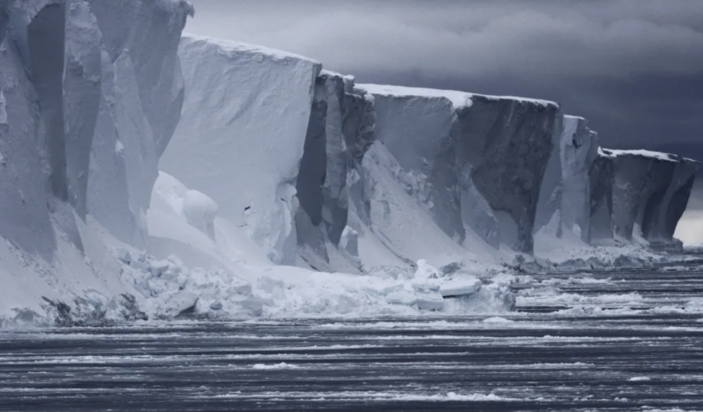
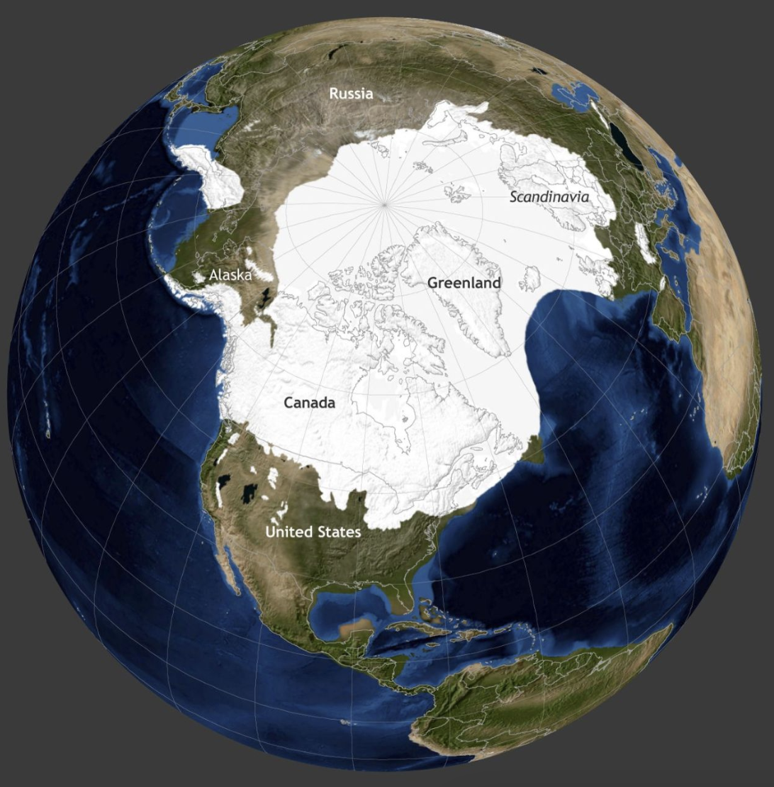
Half a mile high above the sea. Much thicker below the waterline.

(1) Pleistocene Ice Age
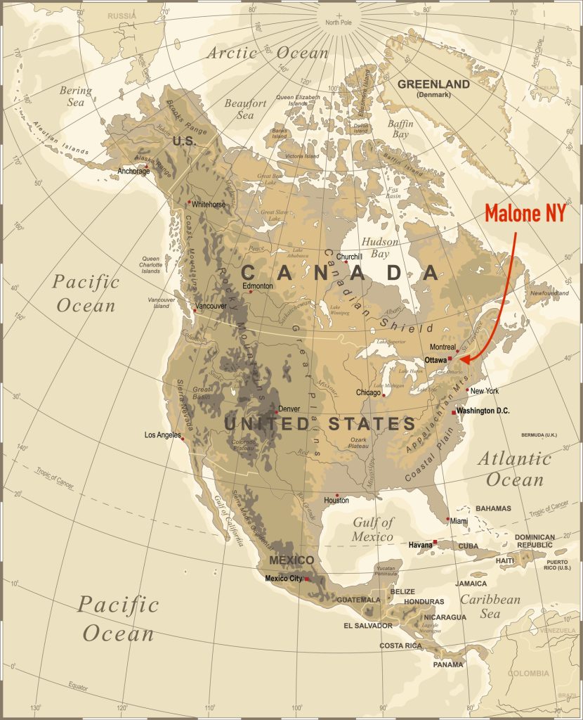
This mind-blowing continental glacier is the beginning of the answer to, "What's so special about Malone's water supply?"
The Pleistocene ("Plice-tow-scene") began around 2.58 million years ago and, frankly, it's still going on. We live in a glacial interlude. The last major thrust of Pleistocene Ice, called the Wisconsin stage, ended around 12,000 B.C.
Between periods of glacial advance, the earth's climate can become extremely warm. For instance, there have been periods in history when both poles (North and South) were tropical. Just so you understand, the earth has always had these dramatic glacial epochs, going back billions of years. The Pleistocene is the 5th in the series.
Back to 12,000 B.C. We're talking about an ice sheet 1 to 2 miles thick. Yes, right over Malone NY. Ice that literally made the continent buckle and sink. Ice that scoured the surface like a gigantic bulldozer with cruel claws made of massive boulders, rocks, stones, down to fine sand.
The earth is an unstable, tempestuous place. The slow pace of the tempest is deceptive; it's slow only on a puny human time-scale. Geological time is a different matter. The planet has always had huge temperature swings—hot to cold—as attested by glaciers coming and going. Within the huge swings are innumerable minor ones, including of course "winter" and summer." As I say, this rodeo ain't over.
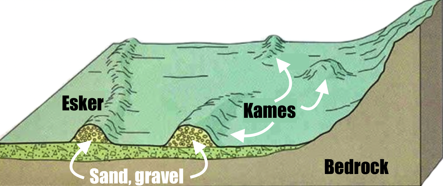
(4) Kames and eskers
This is what's left when all the ice has melted: hummock called "kames" and long embankments or ridges called "eskers." Both are composed of the same glacial debris (boulders, gravel, sand).
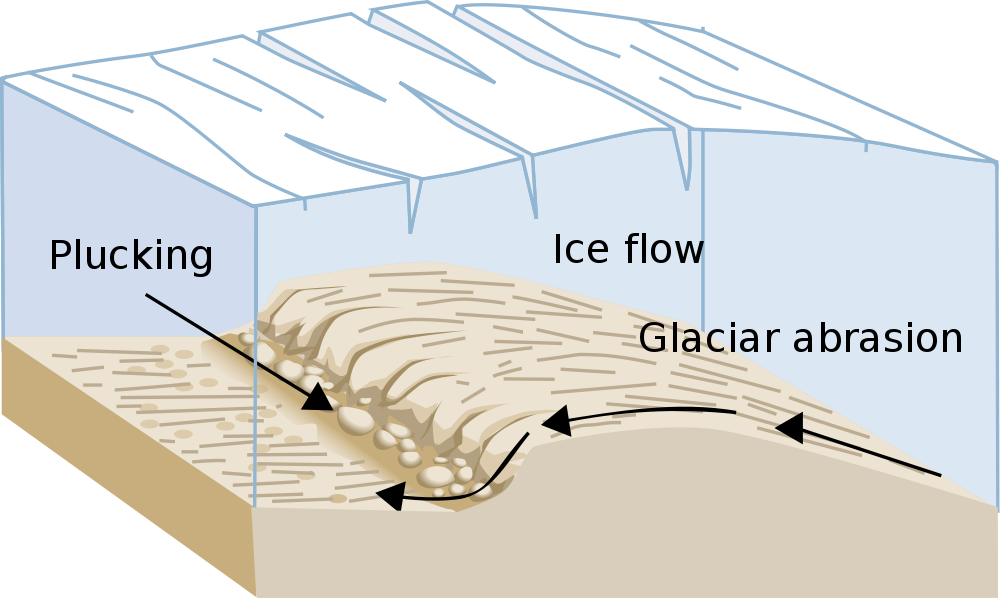
(2) Notice the crevasses (slits) in the glacier
As the glacier melts, the crevasses become rivers—rivers more and more loaded with tumbling, rolling boulders, stones, gravel, and sand. Rivers that slice down into the glacier like a buzz-saw.
When the ice entirely melts, the boulders, stones, gravel, and sand become huge mounds on top of bedrock—mounds called "kames" ("cames").
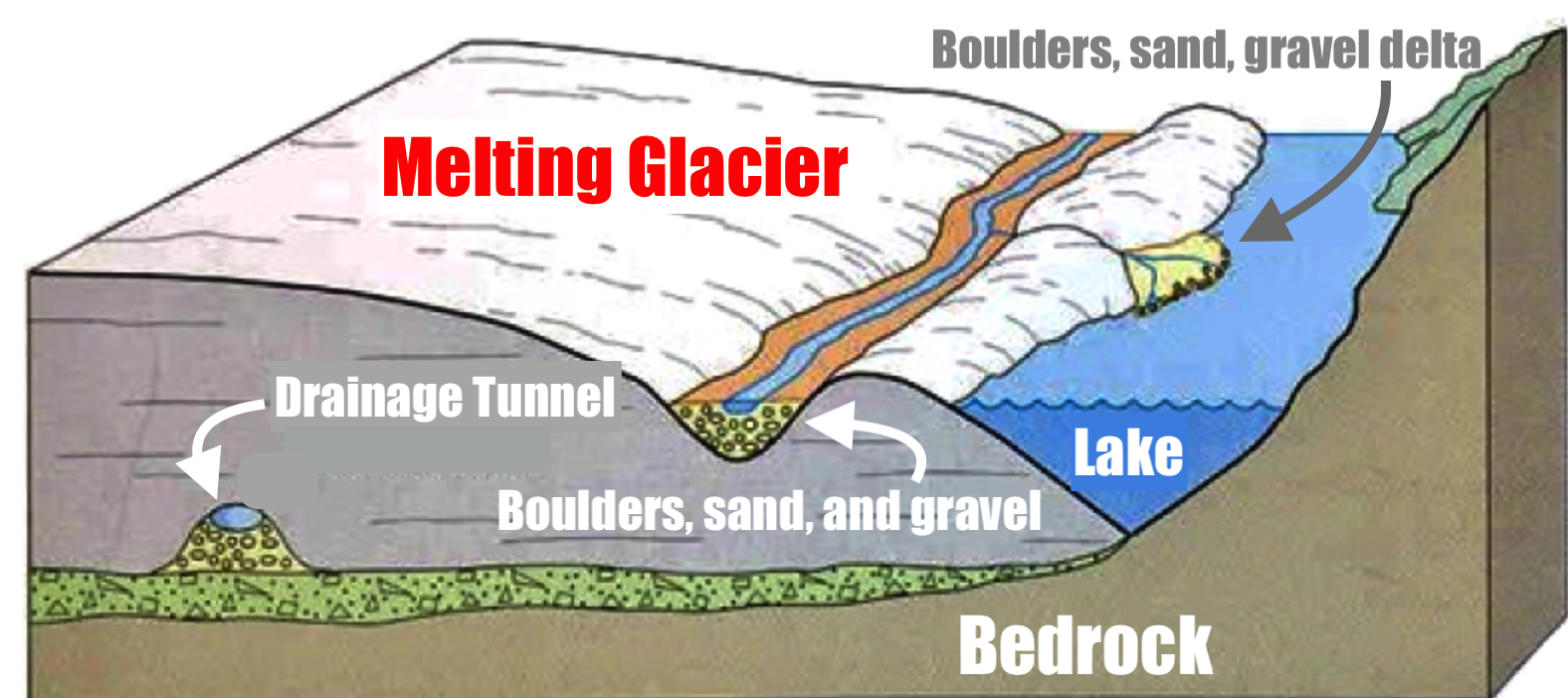
(3) Kame and esker formation
Here's another diagram of kame formation. That is, note the crevasse in the melting glacier, the crevasse that has turned into a turbulent, wild river with a bottom of boulders, sand, and gravel.
To the left, in the same diagram, is another important geological feature in the process of formation. I have titled it a "drainage tunnel." This feature is especially interesting and relevant to Malone's water supply, for this drainage tunnel is actually a lake — a vast lake within the glacier rather than being on top of it. Savor that thought for a moment!
Like the surface river that is loaded with boulders, gravel, and sand, this lake deep within the glacier has a bottom likewise strewn with boulders, stones, and sand. You can see this illustrated in the above diagram.
When the glacier finally completely melts, guess what's left of this interior lake? Yep, you guessed it: a looong, high embankment (ridge) of compact boulders, stones, and sand. This embankment is called an "esker." (See diagram to the left.)
By the way, the surface lake shown in the diagram, above, may remain — as Lake Champlain, or the Great Lakes, or an Adirondack Pond. All these lakes are then fed by groundwater and springs.
6 thoughts on “A Gift from a Glacier”
This aquifer, an invaluable resource, is less vulnerable to pollution than surface water, but not impervious. This week another two million (2,000,000) pounds of sewage sludge will be trucked into Franklin County. Over the past decade, 500,000 tons of these contaminated “bio-solids” have been spread on lands atop our aquifer.
For more information about this dangerous business of pollution for profit, please see:
https://www.sierraclub.org/atlantic/report-sewage-sludge-fertilizer-contaminates-farms-toxic-pfas
It explains why sewage sludge is so contaminated with PFAS “forever chemicals” (as well as numerous other pollutants)–and why it should never be used on farmland, gardens, or on parks or lawns. PFAS can be absorbed through the skin or breathed. Plants take it up. It bio-accumulates up the food chain. It leaches into groundwater and runs off into surface water. It stays in our bodies for decades, and the more we have in our body, the greater the risk of certain cancers, autoimmune disease, etc.
Editor’s response: Wayne, my friend, I believe you are incorrect about bio-solids being spread atop our aquifer. I have examined the geological maps provided by HydroSource Associates (https://teamhydrosource.com) the hydro-geology firm that has been working with the Village since July 2005 in siting, now, 3 Village wells. The maps are included in the reports filed by HydroSource with NYS Dept. of Health and NYS Dept. of Environmental Conservation.
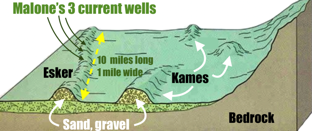
The 10-mile-long, 1-mile-wide aquifer being accessed by the 3 Village wells is, so far as I can tell, located deep beneath soil that does not appear to be farmed. I believe it is nearly all wilderness area, most of it within the Adirondack Park.
I will show these documents and maps in Part 2 of this series.
If you can send me empirical evidence that our aquifer is being threatened by contamination or any sort, I’ll publish it. HydroSource Associates, in its 3 reports (April 2005, July 2015, December 2022) found no evidence of any threat, including contamination from private wells.
Ah, yes, dear author–water is the greatest of our riches. No water? No quality of life. Period. No trees or gardens to get watered. Nowhere to build a home. Nowhere to enjoy the “lesser riches” we seem to treasure so highly as a collective. It’s all coming to a head.
If you live where you have fresh, clean water, stay there. God bless and prosper the geographic Malones out there, and shelter and give wisdom to your people under its abundance.
This is one of the many benefits in our community that we often take for granted and we should be thankful for.
We have so much more to be thankful for, than to be discouraged about in our Star of the North.
That damn global warming melted those glaziers? Today they blame cow farts. I suppose back then it was wooly mammoth farts that warmed the earth.
Wait a minute, could it be those same glaziers are still melting and the vast majority of the green movement is a finacial hustle.
I can’t wait to see the ancient civilizations that were buried under what is still left. Imagine what we will learn.
What an insightful resourceful piece. Thanks, Calvin.
Requires reading a few times. Requires thought and respect for all fresh water sources.
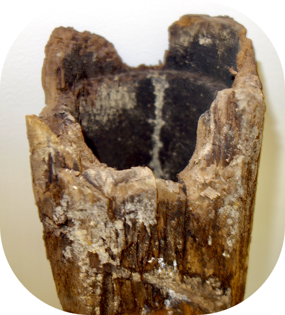
Fascinating history of Malone. Love the water pipe in the Mayor’s office. Let’s not take for granted our water histories!
Editor’s response: Sherri, my dear, since you live in greater
Toronto, I assume you’re getting your drinking water out of, um, Lake Ontario — yes?
Don’t feel bad if you are. I used to live in Los Angeles, Chicago, Santa Fe, Cooperstown NY, Hanover NH (water from the Connecticut River: yikes!), Baltimore (I’m afraid to look up where they get their water), and, ah, New Jersey.
If I’m weird or on the point of death from the sketchy urban water I have consumed in my three-quarters of a century, I’d bet it was chiefly the Jersey water.
By the way, this is one of the principal reasons why Europeans, centuries ago, drank so much booze. It was more trustworthy than the friggin drinking water! I’ll get into this in Part 2.
Clean fresh abundant water is something to be so grateful for. I know I am.
Editor’s response: Hi Robert! Do you have such good water where you live in Mexico?